


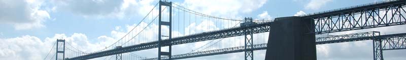
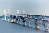
 The Bay Bridge crosses the Chesapeake Bay along US 50/301. Its dual spans provide a direct connection between recreational and ocean regions on Maryland's Eastern Shore and the metropolitan areas of Baltimore, Annapolis and Washington, D.C. At four miles, the spans are among the world's longest and most scenic over-water structures. The original span opened in July 1952 and provides a two-lane roadway for eastbound traffic. The parallel structure opened in June 1973 and has three lanes for westbound travelers. During periods of heavy eastbound traffic, one lane of the westbound bridge is reversed to carry eastbound travelers ("two-way" traffic operations).
FY 2017 traffic volume - 27.2 million vehicles.
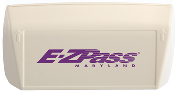
The E-ZPass® electronic-toll-collection system is available at the Bay Bridge.
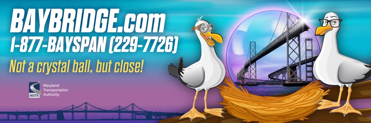
![]() Travel off-peak when crossing from shore to shore.
Travel off-peak when crossing from shore to shore.
Travel off-peak when crossing from shore to shore. The best times to cross the Bay Bridge on weekends include:
- Friday
- Eastbound before 10 a.m. & after 9 p.m.
- Westbound before 10 a.m. & after 8 p.m.
- Saturday
- Eastbound before 7 a.m. & after 6 p.m.
- Westbound before 9 a.m. & after 7 p.m.
- Sunday
- Eeastbound before 10 a.m. & after 7 p.m.
- Westbound before 11 a.m. & after 10 p.m.
Vehicles carrying Class 1 explosives and radioactive materials require an escort to cross the Bay Bridge. For additional information regarding these restrictions, please call 410-537-6601.
- Visit baybridge.com, the official website for the Bay Bridge.
- Visit the Bay Bridge Traffic Advisory page.
William Preston Lane Jr.
Memorial Bridge
850 Revell Highway
Annapolis MD 21409-5559
410-537-6600
1-888-754-0117
TTY 410-355-7024
E-mail: mdta@mdta.maryland.gov
A dream in 1908, a financial impossibility in 1929 and a war-postponed plan in 1940, what now is known as the Bay Bridge became a reality in Jan. 1949, when the first earth was moved for the western approach. It was Nov. 1949 when the first dredge started pumping the bottom of the Chesapeake Bay to make way for the bridge.
The world's largest continuous over-water steel structure when it opened in 1952, the William Preston Lane Jr. Memorial (Bay) Bridge provides a structural link that did not exist in the days when colonial Marylanders traveled by boat, with the Chesapeake Bay as their highway.
Maryland's first settlements developed beside the Bay and along the rivers flowing into the waterway. According to Maryland State Archives records, the Chesapeake was the early colonists' highway and their market house. At that time, the Bay and its estuaries gave tidewater Marylanders a method of communication with each other and with the outside world not available to any other colony on the continent.
Along with the many private boats sailing the Bay prior to the Industrial Revolution, records show a regular ferry running between Kent Island and the Annapolis shore. However, as the population grew and spread inland, the wagon road, the railroad, and, later, the automobile and the motor-truck, gradually relegated the Bay boat to obscurity, and the Chesapeake became a barrier rather than a bond between Eastern Maryland and the rest of the State.
There are recurring stories that, in the 1880s, preliminary studies explored building a bridge across the Bay. In 1907, Peter C. Campbell, Baltimore businessman and State Senator, told his associates that more of the Eastern Shore trade, which had been coming by boat to Baltimore, was going north by highway and railroad to Wilmington and Philadelphia.
The following year, the Merchants and Manufacturers Association developed a report on the feasibility of a privately financed bridge, stretching between Bay Shore and Tolchester, to carry inter-urban trolley lines across the Bay and down the shore.
Talk of a double-deck structure to carry both railroad and trolley lines was circulating in 1919. These ideas were carried a step further in 1927, when a group of Baltimore businessmen was authorized to raise funds to build a Bay Bridge. Detailed plans were developed, but the 1929 stock-market crash put an end to this venture. In the early 1930s, several commissions were appointed to plan for the bridge.
However, all of these efforts required Federal aid, which, unfortunately, was not forthcoming. As the automotive age dawned, the changes first noted in 1907 had multiplied a thousand fold.
By 1919, the demand and pressure for some sort of Bay crossing led to the inauguration of regular ferry service between Annapolis and Claiborne, a 23-mile trip requiring two hours. Aside from the colonial ferry, this was the first regularly scheduled Bay ferry service in the State's history. The Eastern Shore ferry terminal was moved to Matapeake, and, after the State Roads Commission assumed responsibility for the ferry system, the Western Shore terminal was established at Sandy Point.
Mounting pressure for a bridge culminated in 1938, with legislation authorizing the crossing, but World War II postponed the efforts. Under the leadership of Governor William Preston Lane, Jr., during the regular and extraordinary sessions of the 1947 General Assembly, the State Roads Commission was directed to proceed with building a Bay Bridge.
All earlier proposals for a bridge had planned for a crossing in the Bay Shore-Tolchester area. However, by 1938, the growing network of highways on the East Coast, the need to avoid hazardous navigation and the need to provide access to the lower Eastern Shore made a bridge location in the Sandy Point-Matapeake area most desirable.
After four decades of planning and waiting, the first shovelful of earth was turned in Jan. 1949, in the area now occupied by the western approach roadway -- and the largest public project in the history of the State had begun. Underwater work began, and the first permanent piles were driven into the Bay's bottom in March 1950. By the end of the year, the bridge was more than one-third complete. The underwater work had been finished, including construction of the massive concrete piers to support the main towers and the anchor piers to hold the suspension-span cables.
The change in State administration that occurred in Jan. 1951 enabled Governor Theodore McKeldin to move forward with completion of the bridge. In honor of the man whose leadership led to the long-awaited crossing, the bridge was rededicated on Nov. 9, 1967, as the William Preston Lane Jr. Memorial Bridge.
By the early 1960s, it became clear that the bridge's traffic capacity had reached its limit. Various proposals examined temporary measures to relieve congestion during peak-traffic periods. It was apparent, however, that the only permanent relief involved construction of an additional facility.
The 1967 Maryland General Assembly authorized the State Roads Commission to oversee construction of three specific crossings of the Chesapeake Bay. On June 28, 1967, the commission resolved that first priority should be given to construction of an additional bridge at Sandy Point.
On May 28, 1968, the United States Coast Guard granted a permit for construction of the new bridge at a location 450 feet north of the existing crossing at Sandy Point.
- Estimated Annual Traffic:
- 1952: 1.1 million vehicles (eastbound span opened)
- 1972: 6.5 million vehicles
- 1973: 7.3 million vehicles (westbound span opened)
- 1980: 10.2 million vehicles
- 1990: 16.6 million vehicles
- 2000: 23.7 million vehicles
- 2010: 26.4 million vehicles
- 2019: 27.6 million vehicles
- Traffic Capacity (both spans):
- 1,300 -1,500 vehicles per lane, per hour*
*This capacity assumes idealized conditions—factors such as adverse weather, two-way operations, roadwork, and roadway incidents typically reduce capacity
- 1,300 -1,500 vehicles per lane, per hour*
- Construction-Start Dates:
- November 1949 (eastbound span)
- May 1969 (westbound span)
- Opening Dates:
- July 30, 1952 (eastbound span)
- June 28, 1973 (westbound span)
- Construction & Rehabilitation:
- Eastbound Span original construction: $45 million
- Westbound Span original construction: $148 million
- Westbound Span painting (2010): $30.9 million
- Bay Bridge 2022-2027 Consolidated Transportation Program (CTP): $335.7 million
- Location:
- Two-span bridge between Sandy Point and Stevensville, MD
- Overall Lengths:
- Shore-to-shore, including causeway: 4.35 miles (eastbound), 4.33 miles (westbound); Bridge structure abutment to abutment: 4.03 miles (eastbound), 3.987 miles (westbound)
- Height:
- Vertical clearance: 186 feet Height of suspension-bridge towers: 354 feet (eastbound), 379 feet (westbound)